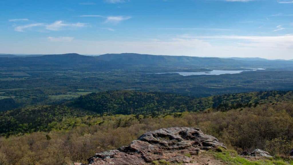

Buffalo National River runs 135 miles through the Ozark Mountains in Arkansas, and it’s one of the last rivers in the lower 48 that hasn’t been dammed up by someone with a big idea. Established in 1972, it was actually the first national river designated in the country, which is the kind of trivia that comes in handy exactly once at a dinner party.
We’ve spent enough weekends here to know it’s not just a float trip destination. Between the limestone bluffs, the quiet pools, and the occasional stretch of rapids that wake you up fast, there’s a reason people from all over Arkansas and beyond keep coming back. Whether you’re here to paddle, hike, camp, or just stare at a genuinely dark sky, the Buffalo tends to deliver.
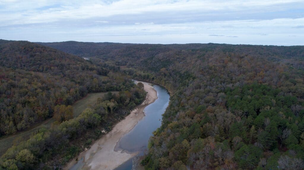
Buffalo National River Overview
Established in 1972, Buffalo National River holds the distinction of being the first national river in the country. That’s a title we don’t say lightly around here, since Newton County folks like reminding out-of-towners about it.
It’s also one of the few undammed rivers left in the lower 48. We’ve never taken that for granted, especially watching it wind 135 miles through the Ozarks without a single dam getting in its way.
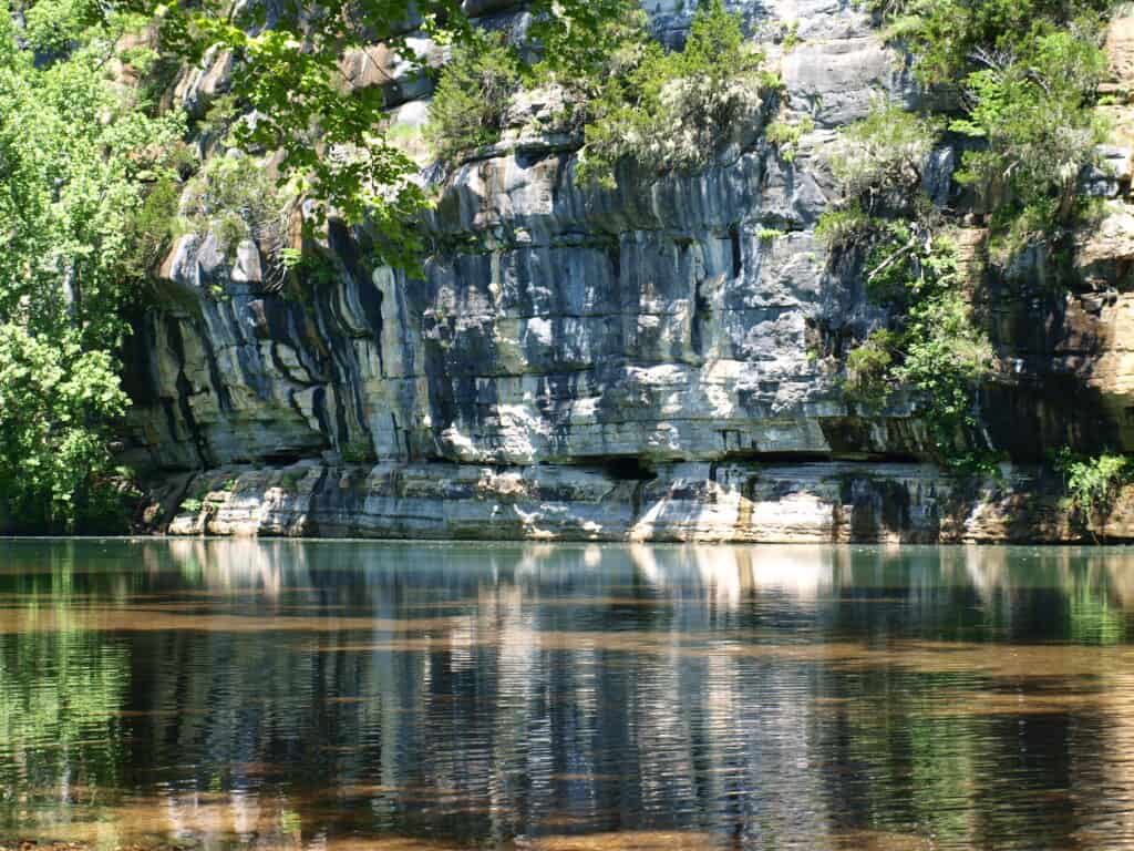
The river runs through northern Arkansas, carving through limestone bluffs that make the whole scene look more dramatic than it has any right to be. The National Park Service manages the river corridor, though only about 11% of the entire watershed falls under their direct oversight, which keeps conservation conversations interesting around here.
We break the river into three sections, and each one has its own personality:
- Upper District – near the Upper Buffalo National River area, this is where the whitewater lives, and where the wilderness feels a bit more untamed
- Middle District – calmer water, good for a lazy float and pretending you’re an outdoorsman
- Lower District – wide, relaxed, and about as stress-free as paddling gets
The upper section kicks off the paddling season each spring, assuming the rain cooperates. We’d suggest checking water levels before loading up the kayak, since this stretch can go from manageable to humbling rather quickly.
The middle and lower districts are friendlier to tubers, casual canoers, and anyone who’d rather not test their luck against a rapid. Campgrounds and river access points are scattered throughout, so finding a place to pitch a tent or launch a boat isn’t much of a chore.
Whether you’re chasing rapids or just floating along half-asleep, we think the Buffalo delivers a fair introduction to what makes the Ozarks worth sticking around for.
Visitor Center and Amenities

We always tell first-timers to start at the Tyler Bend Visitor Center, the main hub for the park’s 95,000 acres. It’s open year-round, located eight miles north of Marshall on Highway 65. The staff there have answered every question we’ve thrown at them over the years, from trail conditions to where the fish are biting.
Amenities are basic, which is more or less the point of a national river. Here’s what you’ll find scattered around the park:
- Clean restrooms
- Picnic areas near popular access points
- Pavilions at select spots for shade and group gatherings
- Limited camping facilities
- Seasonal shuttle services for float trips
There’s no restaurant or bar inside park boundaries, so don’t come expecting a menu. We usually pack sandwiches and let the river provide the ambiance instead.
For anything beyond a picnic, nearby towns like Harrison fill the gap with local diners and a slower pace that suits the area. It’s a short drive, and honestly, part of the Ozark charm is that nobody’s in a hurry to change that.
Bring your own food, use the picnic areas or pavilions, and pack out what you bring in. The amenities here aren’t fancy, but they cover what you actually need for a day on the water or a walk through the woods.
Water Adventures
We won’t pretend the Buffalo National River is anything other than water flowing through rock, but it’s very good water flowing through very good rock. There’s river access at multiple points along the 135 miles, and most of us locals have a favorite put-in spot we’re mildly territorial about.
Canoeing and Kayaking
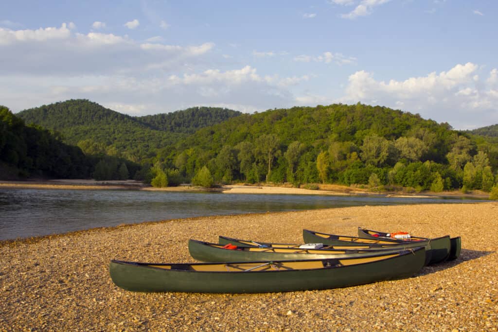
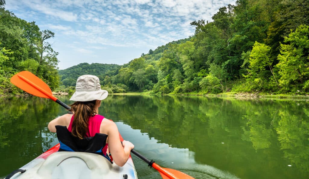
Canoeing and kayaking here cover the full range, from “I’m barely awake” to “I need a helmet.” Outfitters exist for a reason, and unless you happen to own a kayak and a truck, you’ll be renting.
- Outfitters: choose one to handle logistics, because sorting out shuttle service yourself is a good way to lose a morning
- Rentals: canoes and kayaks are available for most skill levels
- Paddling: beginners get calm stretches, the more confident get rapids
The river doesn’t care about your skill level, so pick a section that matches yours.
Rafting and Floating

If paddling sounds like effort, floating is the alternative. It’s the same river, the same cliffs and trees, but with considerably less arm involvement.
- Multi-day float trips: outfitters can arrange longer routes if a single afternoon isn’t enough
- Route options: pick something relaxed or something with a bit more current, depending on your mood
- Essentials: sunscreen, water, snacks, and a life jacket, because the current has no patience for forgetfulness
Whether you’re paddling hard or just drifting along, the water here does most of the scenic work for you.
Hiking and Trails
We’ve spent enough weekends on these trails to know they’re not all created equal. Some will have you strolling with the kids, others will test your knees and your commitment to nature. Buffalo National River covers a lot of ground, so pick your trail based on what kind of day you’re actually up for.
Ozark Mountain Trails
The Ozark trails around here mean forests, elevation, and views that make the climb worth complaining about later. Lost Valley Trail is our go-to recommendation for anyone new to the area, since it packs in a waterfall, a natural bridge, and a cave without demanding too much from your legs.
- Lost Valley Trail
- Length: 2.3 miles
- Difficulty: Easy
If you want more of a workout, Whitaker Point Trail (locals call it Hawksbill Crag) rewards you with some of the best panoramic views in the Ozarks. Just don’t expect to have the overlook to yourself; it’s popular for a reason.
- Whitaker Point Trail
- Length: 2.9 miles
- Difficulty: Moderate
River Bluff Trails
For trails that hug the river itself, we usually point people toward the bluffs. The Big Bluff Trail, also called the Goat Trail, runs along cliffs high above the water and isn’t for anyone with a fear of heights or a loose grip on common sense.
- Big Bluff Trail
- Length: 6.3 miles
- Difficulty: Difficult
Then there’s the Buffalo River Trail, which stretches 37 miles and gives you plenty of trailheads to jump in and out as needed. We rarely do the whole thing in one go, and we don’t recommend you try either unless you’ve got the time and the blisters to spare.
- Buffalo River Trail
- Length: 37 miles
- Difficulty: Moderate to Difficult
We always stick to leave no trace principles out here, since the bluffs and river don’t need our footprints as souvenirs. Bringing the dog along? Certain trails allow it, including the Buffalo Point and Tyler Bend campground trails, Mill Creek Trail, Villines Homestead Trail, and the Buffalo River Trail between Ponca and Steel Creek.
Camping Options

We’ve spent enough nights along this river to know one thing: there’s a campground here for every kind of camper, whether you like your outdoors with a hot shower or without.
Campgrounds Along the River
Steel Creek Campground sits about 3 miles east of Ponca, off Highway 74. It’s got 26 tent sites and 14 horse campsites, all running $20 a night. We like it for the bluffs alone, though the nearby rope swing gets plenty of use from anyone under 40 (and a few of us over it). There’s also a take-out spot if you’re floating in.
Tyler Bend Campground offers a bit more structure, with 10 walk-in tent sites, 28 drive-in sites for RVs or tents, and 2 group sites. Picnic areas, a playground, pavilions, and restrooms round things out. It’s a solid pick if you’re traveling with kids or just prefer not to rough it completely.
Buffalo Point Campground is the closest thing to “civilized camping” you’ll find out here. With 83 sites, flush toilets, showers, and laundry facilities, it’s open year-round for both RV and tent campers. There’s also an amphitheater and a few historic structures nearby if you want a break from the river itself.
Beyond these three, the park includes other camping areas worth knowing about, including Pruitt, Woolum, and Hasty, all more rustic and river-adjacent, better suited to those who don’t mind fewer amenities in exchange for quiet.
The full list of campgrounds includes options for:
- Tent campers
- RV campers with hookup needs
- Horse camping
- Group sites
- Primitive river-access camping
Whatever your camping style, we can say from experience that the Buffalo National River area doesn’t leave you short on choices.
Fishing and Wildlife
We fish here more than we probably should admit, and the river doesn’t seem to mind. Smallmouth bass dominate upstream, but drift down past Pruitt and you’ll start pulling in spotted bass and largemouth too.
Catfish and perch round out the usual haul. Nothing exotic, just solid, reliable fishing in water clear enough to second-guess your own cast.
Before you get too excited, check the Arkansas Fishing Guidebook. Rules exist, rangers enforce them, and “I didn’t know” has never worked as well as people hope.
Wildlife Watching

Wildlife here doesn’t perform on command, but it shows up often enough to keep us looking. White-tailed deer are common, elk make appearances, and the bird list is long enough to bore a non-birder within minutes.
The Ponca Wilderness is our go-to for this. It’s quieter, wilder, and less trafficked than the postcard spots.
Our advice: go early morning or late afternoon, when animals are actually moving instead of hiding from the heat. Keep your distance, stay quiet, and resist the urge to narrate everything you see. The animals don’t care about your commentary, and honestly, neither do we.
Outdoor Activities
Buffalo National River gives us plenty of ways to get outside without needing a PhD in adventure sports. Two of our favorites happen to involve a set of wheels or four legs that aren’t our own.
Equestrian Trails and Horseback Riding
We’ve got several horseback riding trails that wind through forests, along riverbanks, and across meadows. It’s a slower pace than paddling, but the view from a saddle has its own appeal.
If you’re bringing your own horse, check the park’s rules first. A few trails close seasonally, and nothing ruins a planned ride like showing up to a locked gate.
Things worth knowing before you go:
- Trail conditions change with weather, so call ahead or check the park website.
- Some routes cross shallow water, which horses generally tolerate better than we do.
- Night sky viewing after an evening ride is a nice bonus, assuming your horse doesn’t mind standing around while you stare up at the stars.
Mountain Biking
Mountain biking here is limited to designated multi-use trails, which keeps things sane for hikers, riders, and cyclists alike. The mountain biking trails range from easygoing to genuinely tough, with climbs that will test your legs and descents that make the climb worth it.
We’ve spotted white-tailed deer and the occasional elk mid-ride, which is a good reminder to keep your eyes up, not just on the trail. Bird species are common too, though they’re generally less startled by bikes than the deer are.
Whether it’s on horseback or a bike, this stretch of Arkansas rewards a little effort with scenery that doesn’t need much embellishment.
Historic and Prehistoric Sites
We like to remind our kids that people were figuring out this river valley long before anyone had a smartphone to complain about the lack of signal. Human history here goes back roughly 10,000 years, and the park does a decent job of holding onto the evidence.
The Boxley Historic District near Ponca is one of our regular stops. The old Boxley Mill once served as the neighborhood gathering point, back when waiting for your flour to grind counted as socializing. The Villines family name comes up a lot around here, tied closely to how Newton County developed.
Over at Erbie, you get a different flavor of history: mining. It’s not glamorous, but the leftover structures and mine remnants give a fairly honest look at how hard people worked to scrape a living out of these hills.
For older history, the park has scattered prehistoric village and shelter sites, some more than 10,000 years old. We won’t pretend to be archaeologists, but standing in these spots does put our own daily problems into perspective.
A few highlights worth building a stop around:
- Boxley Mill – historic gathering site and mill structure
- Villines family sites – tied to Newton County’s early development
- Erbie mining district – remnants of past mining operations
- Prehistoric shelter and village sites – scattered throughout the park, some over 10,000 years old
None of this requires a history degree to appreciate. Just good boots, a little curiosity, and maybe a snack for the kids so they stop asking “how much longer” before we’ve read a single sign.
Natural Features and Scenery
The Ozarks did most of the design work here, and honestly, they didn’t need our help. Limestone bluffs rise up along the river, shaped by water that’s been at it for a very long time. Underneath all that scenery, the geology gets interesting fast.
Caves
We’ve poked around a fair number of limestone caves in this area, and each one feels like its own small underground weather system. They’re a solid draw for anyone who likes their adventures slightly damp and echoey.
That said, we always check the National Park Service guidelines before heading in. Caves are fragile, and so, occasionally, are ankles.
A few practical notes we’ve picked up:
- Bring your own light source (your phone flashlight will not save you)
- Watch for seasonal closures, especially bat-related ones
- Wear shoes you don’t mind getting muddy, because you will
Springs
Springs are the quiet workhorses of this river system, feeding it steadily without asking for much credit. Woolum is one worth mentioning, where a spring-fed creek joins the Buffalo and creates a genuinely peaceful spot to sit for a while.
These springs also do a lot of heavy lifting for local wildlife, keeping the water cool and the ecosystem humming along.
And then there’s Hemmed-in Hollow Waterfall, which we’d argue is the showstopper of the whole park. Billed as the tallest waterfall between the Rockies and the Appalachians, it’s the kind of view that makes the hike in feel entirely justified, sore knees and all.
Travel and Lodging

Cabin Rentals
We’re partial to the cabins at Buffalo Point, the only accommodations actually inside the park boundary. There’s a mix of rustic and modern options, so you can rough it or not, depending on how much you like your family.
A few things worth knowing:
- Buffalo Point Concession runs the show here, not some outside outfit.
- Reservations open up to 15 months in advance, and they do fill up.
- Location puts you close to hiking, canoeing, and kayaking without much of a drive.
If you want to wake up near the river instead of driving to it, this is the practical choice.
Hotels and Motels
If cabins aren’t your thing, or they’re booked (likely, since everyone else had the same idea), Harrison, Marshall, and Yellville all have hotels and motels within a reasonable drive of the park. We’ve stayed in all three towns at one point or another, and each works fine as a home base.
Harrison tends to have the most options, which makes sense given its size relative to the other two.
Peak season runs Memorial Day through Labor Day, so expect fewer vacancies and higher rates during that stretch. Outside those months, you’ll have an easier time finding a room without planning six weeks ahead.
For a broader list of lodging beyond what we’ve covered, Buffalo River – National Park Region has more options worth a look.

River Conditions and Safety
The river doesn’t care about our vacation plans, so we’ve learned to check conditions before we load up the canoe. Weather and water levels run the show here, and ignoring either one is how folks end up with a story that starts with “so this park ranger pulled me out of the water.”
Weather
Rain upstream means rising water downstream, sometimes faster than you’d expect from a place that looks this peaceful. We always check the forecast before heading out, since a sunny morning at our house doesn’t mean much if it’s been pouring in the hills for two days. The National Park Service website keeps current weather info handy, and we’ve made it a habit to glance at it the night before any float trip.
Water Levels
River flow varies quite a bit between the Upper and Lower Buffalo, thanks to the different terrain each section cuts through. What’s a lazy float in one spot can turn into something more serious a few miles downstream.
Gauges along the river track these changes, and they’re genuinely useful once you learn to read them:
- Upper Buffalo – narrower, quicker to rise
- Lower Buffalo – wider, generally more forgiving
We recommend checking the water level details before committing to a route.
With over 94,000 acres of backcountry involved, the park expects visitors to look after themselves, and we think that’s fair. A quick read of the safety guidelines beats learning the hard way.
Parks and Recreation Areas
We think of Buffalo National River less as a single park and more as a long, skinny collection of them, stretched across 135 miles of Ozark scenery. The National Park Service manages the whole stretch, which means one website, one set of rules, and still somehow endless ways to get turned around.
The Upper Buffalo is where most first-timers end up, and Ponca is the small town that anchors it. It’s not much more than a bend in the road, but it’s a reliable starting point for float trips, hikes, and general outdoor mayhem. The Buffalo Outdoor Center sits nearby and handles canoe rentals, kayak trips, camping needs, and guided tours for anyone who’d rather not learn river navigation the hard way.
Ponca isn’t alone up there. Boxley and Erbie round out the upper section, both quieter and both worth a look if you want scenery without the crowds.
Downstream, things slow down. The Lower Buffalo trades some of the excitement for solitude, and areas near Buffalo City offer a good excuse for a scenic drive rather than a full day of paddling.
Getting to any of these spots means using Highways 7, 43, or 62/65 out of Harrison. We’d suggest trusting a paper map over GPS, since cell service in these hollows is more theoretical than actual.
Camping is available throughout, upper and lower alike, with options ranging from bare-bones tent sites to spots with electric hookups for people who consider a hot shower non-negotiable.
For those wanting more than a self-guided wander, the park authorizes several guided services that know the terrain better than we ever will.
Buffalo National River Business
We’ve watched the outfitting business grow along this river for years, and it’s a decent living if you don’t mind wet shoes.
Several outfitters run float trips down the Buffalo, catering to everyone from first-timers who can barely hold a paddle to folks who’ve done this a hundred times. Companies like Buffalo Outdoor Center offer canoe and kayak rentals, shuttle services, and guided trips, which saves us the trouble of explaining to out-of-towners why they just floated three miles past their car.
Lodging options fill in the gaps around towns like Harrison, ranging from rustic cabins to standard hotel rooms. The National Park Service campgrounds along the river offer a more basic experience, with amenities that vary by location, so it’s worth checking ahead unless you enjoy surprises involving pit toilets.
Local dining leans toward Arkansas comfort food, and the shops nearby stock the usual souvenirs alongside gear you probably should have packed in the first place.
A few things to expect from local businesses:
- Canoe and kayak rentals with shuttle service
- Guided fishing and float trips
- Cabin and lodge rentals
- Campground access near the riverbanks
- Local restaurants and small-town shopping
The businesses here don’t try to be flashy. They just keep visitors fed, floated, and pointed in the right direction, which around here counts as excellent customer service.
Conclusion
Buffalo National River doesn’t need much dressing up. It’s 135 miles of free-flowing water, tall bluffs, and Ozark scenery that hasn’t been fussed with since 1972, and we think that’s part of the charm.
Whether we’re floating a lazy stretch, hiking a bluff trail, or just parked at a campsite listening to the elk bugle in the distance, the place delivers without much fanfare.
A few things stick with us after each visit:
- The water stays the star. No dams, no reservoirs, just a river doing what rivers do.
- There’s room for everyone. Paddlers, hikers, anglers, and folks who just want to sit by the water all find their spot.
- History is part of the package. The bluffs and old homestead sites remind us this land has a story beyond the scenery.
We keep coming back not because it’s flashy, but because it isn’t. Some places don’t need improving, and this is one of them.
Guide To Johnsons Shut Ins State Park (All The “Must-Knows”)
5 Must-See Caves Near Branson Missouri (With Pics)
Buffalo National River Visitor’s Guide (Must-Visit Spots)
The Best Luxury Resorts in the Ozarks (There are Many!)
Does it Snow in Arkansas? (Yes, here’s where & how much…)